 HoodRadar
neighbourhood · Toronto
Living in Alderwood: A Data Snapshot
The neighbourhood report card
Overall grade : C
- CSafety11.1
- DBreak-ins2.0
- BGreen space66,327.0
- CParkland share6.4%
How these grades are computed
Grades from A to E, computed automatically from open data (police, city, census). Each criterion ranks this neighbourhood against the other neighbourhoods of the same city: A for the best-placed fifth, E for the lowest fifth. A relative position, not a verdict.
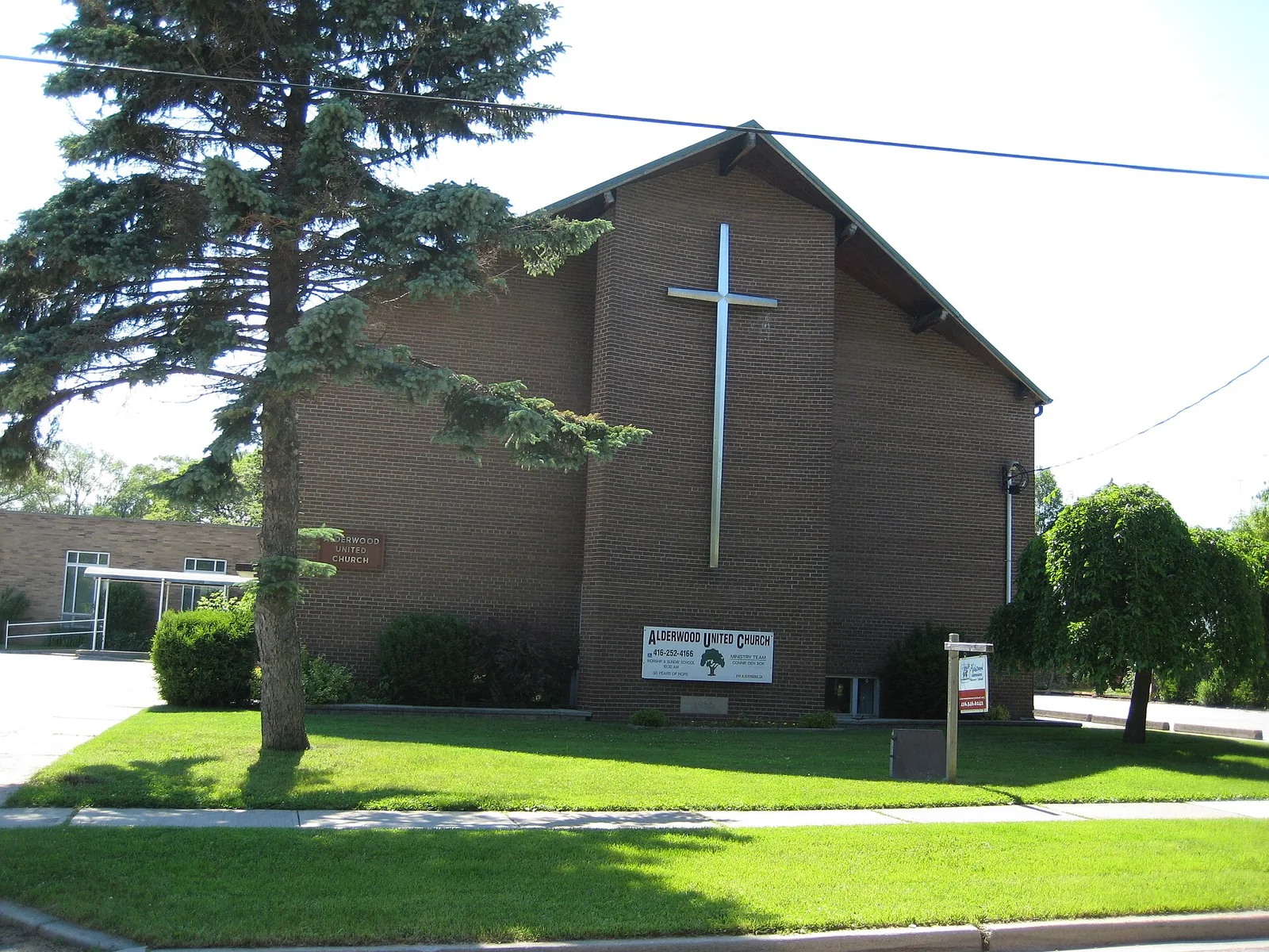
Alderwood sits among Toronto's 158 neighbourhoods with a crime rate of 11.1, below the city average and a break-in rate described as close to the city average. With 4,785 occupied dwellings and 8 parks covering 6.4% of its land, the area offers a mix of housing stability and outdoor space worth weighing against regional rents.
Crime and Safety
Toronto Police Service recorded 159 major crimes in Alderwood over the latest year, up from 145 the year before, a change of 9.7%. Assaults make up the largest share of incidents, at 45.9% of the total, followed by vehicle thefts, robberies and major thefts in smaller numbers. The overall trend is stable, and the neighbourhood's rate of 11.1 sits below the city average compared with the citywide rate of 13.2.
Break-ins add another dimension: 29 were reported, putting Alderwood's rate at 2.0, close to the city average next to the city's 1.9. The break-in trend is stable, which matters for anyone weighing home security measures against a quieter overall crime picture. Alderwood ranks 79 among Toronto neighbourhoods on major crime rate, with a lower position indicating a safer standing relative to others.
19 of 33: the lowest, the highest and Alderwood's neighbours.
Break-ins per 1,000 residents in 2025, all of Toronto : 1.9
Housing Stock
Alderwood counts 4,785 occupied dwellings, and the mix leans heavily toward low-rise living: only 4.5% of homes are condominiums, and just 7.8% sit in tall apartment buildings. Renters make up 23.2% of households here, a smaller share than the citywide figure of 48.1%, pointing to a neighbourhood where ownership is more common than renting.
The housing stock is also notably mature: 54.4% of dwellings were built up to the early post-war years. That age profile tends to mean established streets and settled block patterns rather than recent infill, which can matter for buyers weighing maintenance expectations against character.
13 of 33: the lowest, the highest and Alderwood's neighbours.
Share of renter households, all of Toronto : 48.1%
Parks and Outdoor Life
Families looking at Alderwood have 8 municipal parks to work with, part of the City of Toronto's parks inventory, together covering 6.4% of the neighbourhood's land. Park area per dwelling comes in close to the city average next to the citywide figure, measured as 66,327.0 against Toronto's 69,239.0.
The largest of these is Etobicoke Valley Park. Beyond green space, the neighbourhood has 5 children's playgrounds, 4 outdoor sports fields and courts, and 4 community centres, giving families a reasonable spread of places to spend time outdoors without needing a car.
19 of 33: the lowest, the highest and Alderwood's neighbours.
Share of land occupied by parks, all of Toronto : 12.5%
Rents in the Toronto Region
Alderwood itself doesn't have its own published rent figures, but CMHC's regional averages for the Toronto area offer useful context for anyone comparing housing costs. Bachelor units average $1,491 across the region, while smaller units run $1,761. Family-sized units average $2,045, and the largest units climb to $2,294.
These are regional benchmarks, not Alderwood-specific figures, so actual listings in the neighbourhood may differ depending on building age, condo share and local demand.
Practical Notes for Newcomers
With break-ins sitting at a rate described as close to the city average and a trend that is stable, it's reasonable for both buyers and renters to budget for basic home security, whether that's better door and window hardware or simply knowing neighbours on the block. Renters, who make up 23.2% of households here, may want to look into tenant insurance given the share of older housing stock, since 54.4% of dwellings predate the early post-war years and can carry different maintenance realities than newer builds.
Buyers comparing Alderwood against regional rents should factor in mortgage pre-approval early, particularly given the low condominium share of 4.5%, which means most purchases here involve freehold properties rather than condo fees and reserve funds.
Frequently asked questions
Is Alderwood safe compared to the rest of Toronto?
Alderwood's major crime rate of 11.1 sits below the city average relative to the citywide rate of 13.2, and the trend has been stable. Break-ins are close to the city average, with a rate of 2.0 against the city's 1.9.
What is the housing mix like in Alderwood?
Out of 4,785 occupied dwellings, condominiums make up 4.5% and tall apartment buildings account for 7.8%. Renters represent 23.2% of households, and 54.4% of homes were built up to the early post-war years.
How much green space does Alderwood have?
The neighbourhood has 8 municipal parks covering 6.4% of its land, including Etobicoke Valley Park as the largest. There are also 5 playgrounds, 4 outdoor sports facilities and 4 community centres.
All the data
| Indicator | Value | Source |
|---|---|---|
| Kilometres of bike lanes, cycle tracks and trails | 3 | Cycling network |
| Break-ins in 2025 Period : 2025 | 29 | Neighbourhood crime rates |
| Break-ins compared with the city Period : 2025 | close to the city average | Neighbourhood crime rates |
| Break-ins per 1,000 residents Period : 2025 | 2.0 | Neighbourhood crime rates |
| Year-over-year break-in trend Period : 2025 | stable | Neighbourhood crime rates |
| Community centres | 4 | Parks and recreation facilities |
| Share of dwellings in condominiums Period : 2021 | 4.5% | Neighbourhood profiles, 2021 Census |
| Year-over-year change in major crimes Period : 2025 | 9.7% | Neighbourhood crime rates |
| Major crime rate compared with the city Period : 2025 | below the city average | Neighbourhood crime rates |
| Rank by major crime rate (1 = lowest) Period : 2025 | 79 | Neighbourhood crime rates |
| Major crimes per 1,000 residents Period : 2025 | 11.1 | Neighbourhood crime rates |
| Year-over-year major crime trend Period : 2025 | stable | Neighbourhood crime rates |
| Major crimes reported in 2025 Period : 2025 | 159 | Neighbourhood crime rates |
| Major crimes reported in 2024 Period : 2024 | 145 | Neighbourhood crime rates |
| Occupied dwellings (2021 Census) Period : 2021 | 4,785 | Neighbourhood profiles, 2021 Census |
| Park area per dwelling compared with the city | close to the city average | Green spaces |
| Dwellings in buildings of five or more storeys Period : 2021 | 7.8% | Neighbourhood profiles, 2021 Census |
| Largest park in the neighbourhood | Etobicoke Valley Park | Green spaces |
| Parks | 8 | Green spaces |
| Share of land occupied by parks | 6.4% | Green spaces |
| Square metres of park per 1,000 dwellings | 66,327.0 | Green spaces |
| Children's playgrounds | 5 | Parks and recreation facilities |
| Population (2025, police estimate) Period : 2025 | 14,367 | Neighbourhood crime rates |
| Dwellings built in 1960 or earlier Period : 2021 | 54.4% | Neighbourhood profiles, 2021 Census |
| Share of renter households Period : 2021 | 23.2% | Neighbourhood profiles, 2021 Census |
| Outdoor sports fields and courts | 4 | Parks and recreation facilities |
| Most frequent category Period : 2025 | assaults | Neighbourhood crime rates |
| Share of the most frequent category Period : 2025 | 45.9% | Neighbourhood crime rates |
Regional context
| Indicator | Value | Source |
|---|---|---|
| Neighbourhoods covered | 158 | Toronto neighbourhoods (158) |
| Kilometres of bike lanes, cycle tracks and trails, all of Toronto | 661 | Cycling network |
| Break-ins per 1,000 residents in 2025, all of Toronto Period : 2025 | 1.9 | Neighbourhood crime rates |
| Major crimes per 1,000 residents in 2025, all of Toronto Period : 2025 | 13.2 | Neighbourhood crime rates |
| Share of land occupied by parks, all of Toronto | 12.5% | Green spaces |
| Square metres of park per 1,000 dwellings, all of Toronto | 69,239.0 | Green spaces |
| Share of renter households, all of Toronto Period : 2021 | 48.1% | Neighbourhood profiles, 2021 Census |
| Average rent, Toronto CMA: one bedroom Period : 2025 | $1,761 | Average rents (Rental Market Survey) |
| Average rent, Toronto CMA: two bedrooms Period : 2025 | $2,045 | Average rents (Rental Market Survey) |
| Average rent, Toronto CMA: three bedrooms or more Period : 2025 | $2,294 | Average rents (Rental Market Survey) |
| Average rent, Toronto CMA: bachelor Period : 2025 | $1,491 | Average rents (Rental Market Survey) |
| Rent survey year | 2025 | Average rents (Rental Market Survey) |
Comments
No comments yet.