 HoodRadar
neighbourhood · Toronto
Don Valley Village in numbers
The neighbourhood report card
Overall grade : C
- BSafety10.1
- ABreak-ins0.9
- DGreen space23,721.0
- CParkland share5.8%
How these grades are computed
Grades from A to E, computed automatically from open data (police, city, census). Each criterion ranks this neighbourhood against the other neighbourhoods of the same city: A for the best-placed fifth, E for the lowest fifth. A relative position, not a verdict.
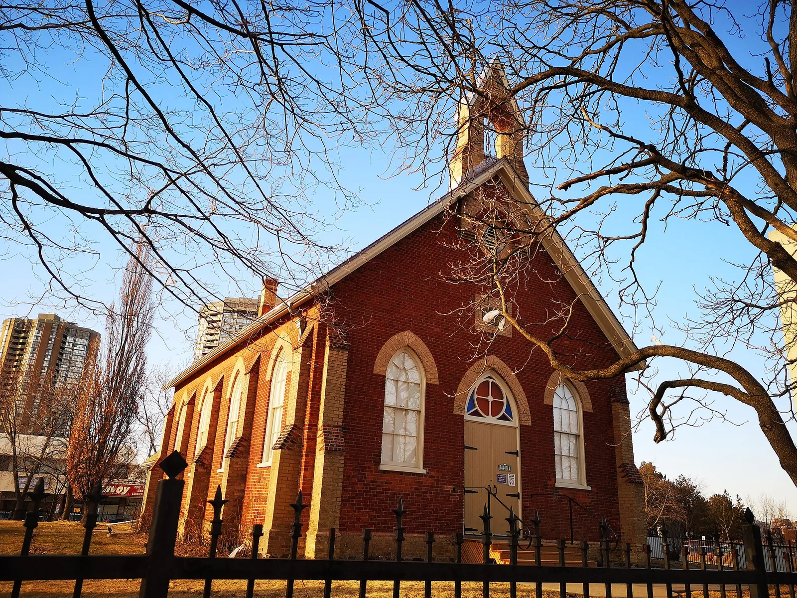
With a police-estimated population of 31,066, Don Valley Village recorded 314 major crimes in the latest year of Toronto Police Service data, a rate of 10.1 that sits below the city average. Tall apartment buildings hold 58.2% of the housing stock, and renters make up 49.3% of households. Parkland is thinner here than across the city as a whole, at 5.8% of the neighbourhood's land.
Crime and safety
The Toronto Police Service counted 314 major crimes in Don Valley Village in the most recent year of data, down from 429 the year before, a change of -26.8%. The trend is falling. Those figures cover assaults, break-ins, robberies, vehicle thefts and major thefts.
Assaults dominate the count: assaults account for 55.7% of major crimes recorded here. Break-ins are the category most people ask about when they move, and there were 29 of them, giving a rate of 0.9 against 1.9 for Toronto as a whole. That puts break-ins below the city average, and the year-over-year direction is falling.
Measured against the rest of the city, the overall major crime rate of 10.1 compares with 13.2 citywide, which ranks Don Valley Village 63 among the 158 neighbourhoods covered here, where the lowest rank means the lowest rate.
14 of 33: the lowest, the highest and Don Valley Village's neighbours.
Break-ins per 1,000 residents in 2025, all of Toronto : 1.9
Housing stock
The census counts 10,235 occupied dwellings in Don Valley Village. Apartment living is the norm: 58.2% of homes sit in tall apartment buildings, and condominium tenure covers 32.9% of the stock, so a buyer here is far more likely to be looking at a unit with monthly fees than at a freehold house.
Renters hold 49.3% of households, close to the citywide share of 48.1%. Older housing is a small part of the picture, with 11.0% of dwellings dating from the early post-war period or before; most of what you will tour was built later, which usually means larger floor plates and elevator buildings rather than walk-ups.
19 of 33: the lowest, the highest and Don Valley Village's neighbours.
Share of renter households, all of Toronto : 48.1%
Parks and outdoor life
The City of Toronto's municipal parks inventory lists 12 parks in Don Valley Village, covering 5.8% of its land against 12.5% citywide. Park area per dwelling comes to 23,721.0 on the measure shown in the table, compared with 69,239.0 for Toronto, which places the neighbourhood below the city average. With so many households in apartments, green space here is shared rather than private.
Dallington Park is the biggest of them. For families, the inventory also records 10 children's playgrounds, 9 outdoor sports fields and courts, and 3 community centres, which matters more in a place where most homes have no backyard. Privately owned or school grounds are not included in these counts.
19 of 33: the lowest, the highest and Don Valley Village's neighbours.
Share of land occupied by parks, all of Toronto : 12.5%
Rents in regional context
CMHC's rent survey reports averages for the Toronto region as a whole, not for Don Valley Village specifically, so treat them as a benchmark rather than a price list for this neighbourhood. For the 2025 survey, bachelor units averaged $1,491 and smaller units $1,761.
Family-sized units averaged $2,045 across the region, and the largest units $2,294. Asking rents in a given building can sit well above or below these averages depending on age, condition and whether the unit is condominium stock, which is a sizeable part of what rents here given the 32.9% condominium share.
Moving here: what to check
Break-ins run below the city average in Don Valley Village, at a rate of 0.9 versus 1.9 citywide, so basic precautions are usually enough: know how your building handles visitor access and parcel delivery, and ask the property manager what is covered by building security and what is not.
Since 49.3% of households rent, tenant insurance is worth arranging before move-in day; most landlords ask for proof of it, and the building's policy does not cover your belongings. Buyers should remember that 32.9% of dwellings are condominiums: get a mortgage pre-approval that accounts for monthly fees, and read the reserve fund study and status certificate before committing.
If you are moving with children, check which of the 10 playgrounds and 3 community centres are within walking distance of the specific address, because parkland is unevenly spread across a neighbourhood where parks cover 5.8% of the land.
Frequently asked questions
Is Don Valley Village a safe neighbourhood?
On the most recent year of Toronto Police Service data, Don Valley Village recorded 314 major crimes for a rate of 10.1, below the city average of 13.2. The trend is falling, with a year-over-year change of -26.8%, and break-ins stood at 29.
What kind of housing can I expect to find?
Of the 10,235 occupied dwellings counted in the census, 58.2% are in tall apartment buildings and 32.9% are condominiums. Renter households make up 49.3%, close to the Toronto share of 48.1%. Only 11.0% of the stock is older housing.
How much green space is there for families?
The City's parks inventory lists 12 parks covering 5.8% of the land, with Dallington Park the largest. Park area per dwelling is 23,721.0 against 69,239.0 citywide, placing Don Valley Village below the city average. There are also 10 playgrounds and 9 outdoor sports fields and courts.
All the data
| Indicator | Value | Source |
|---|---|---|
| Kilometres of bike lanes, cycle tracks and trails | 1 | Cycling network |
| Break-ins in 2025 Period : 2025 | 29 | Neighbourhood crime rates |
| Break-ins compared with the city Period : 2025 | below the city average | Neighbourhood crime rates |
| Break-ins per 1,000 residents Period : 2025 | 0.9 | Neighbourhood crime rates |
| Year-over-year break-in trend Period : 2025 | falling | Neighbourhood crime rates |
| Community centres | 3 | Parks and recreation facilities |
| Share of dwellings in condominiums Period : 2021 | 32.9% | Neighbourhood profiles, 2021 Census |
| Year-over-year change in major crimes Period : 2025 | -26.8% | Neighbourhood crime rates |
| Major crime rate compared with the city Period : 2025 | below the city average | Neighbourhood crime rates |
| Rank by major crime rate (1 = lowest) Period : 2025 | 63 | Neighbourhood crime rates |
| Major crimes per 1,000 residents Period : 2025 | 10.1 | Neighbourhood crime rates |
| Year-over-year major crime trend Period : 2025 | falling | Neighbourhood crime rates |
| Major crimes reported in 2025 Period : 2025 | 314 | Neighbourhood crime rates |
| Major crimes reported in 2024 Period : 2024 | 429 | Neighbourhood crime rates |
| Occupied dwellings (2021 Census) Period : 2021 | 10,235 | Neighbourhood profiles, 2021 Census |
| Park area per dwelling compared with the city | below the city average | Green spaces |
| Dwellings in buildings of five or more storeys Period : 2021 | 58.2% | Neighbourhood profiles, 2021 Census |
| Largest park in the neighbourhood | Dallington Park | Green spaces |
| Parks | 12 | Green spaces |
| Share of land occupied by parks | 5.8% | Green spaces |
| Square metres of park per 1,000 dwellings | 23,721.0 | Green spaces |
| Children's playgrounds | 10 | Parks and recreation facilities |
| Population (2025, police estimate) Period : 2025 | 31,066 | Neighbourhood crime rates |
| Dwellings built in 1960 or earlier Period : 2021 | 11.0% | Neighbourhood profiles, 2021 Census |
| Share of renter households Period : 2021 | 49.3% | Neighbourhood profiles, 2021 Census |
| Outdoor sports fields and courts | 9 | Parks and recreation facilities |
| Most frequent category Period : 2025 | assaults | Neighbourhood crime rates |
| Share of the most frequent category Period : 2025 | 55.7% | Neighbourhood crime rates |
Regional context
| Indicator | Value | Source |
|---|---|---|
| Neighbourhoods covered | 158 | Toronto neighbourhoods (158) |
| Kilometres of bike lanes, cycle tracks and trails, all of Toronto | 661 | Cycling network |
| Break-ins per 1,000 residents in 2025, all of Toronto Period : 2025 | 1.9 | Neighbourhood crime rates |
| Major crimes per 1,000 residents in 2025, all of Toronto Period : 2025 | 13.2 | Neighbourhood crime rates |
| Share of land occupied by parks, all of Toronto | 12.5% | Green spaces |
| Square metres of park per 1,000 dwellings, all of Toronto | 69,239.0 | Green spaces |
| Share of renter households, all of Toronto Period : 2021 | 48.1% | Neighbourhood profiles, 2021 Census |
| Average rent, Toronto CMA: one bedroom Period : 2025 | $1,761 | Average rents (Rental Market Survey) |
| Average rent, Toronto CMA: two bedrooms Period : 2025 | $2,045 | Average rents (Rental Market Survey) |
| Average rent, Toronto CMA: three bedrooms or more Period : 2025 | $2,294 | Average rents (Rental Market Survey) |
| Average rent, Toronto CMA: bachelor Period : 2025 | $1,491 | Average rents (Rental Market Survey) |
| Rent survey year | 2025 | Average rents (Rental Market Survey) |
Comments
No comments yet.